Showing posts with label hiking. Show all posts

Sunday, September 26, 2021

Going Down is Optional; Going Up is Mandatory

Let me take you on an adventure- a beautiful, challenging adventure into the Grand Canyon very few get to see.

Did you know less than 5% of the annual 6 million visitors to the canyon go below the rim? Of those 6 million tourists, less than 1% attempts a Rim2Rim hike. Three months ago I knew very little about this challenge. For the past two months I’ve lived & breathed it.

The Grand Canyon Rim2Rim hike typically begins on the canyon’s north rim and crosses through the canyon floor up to the southern rim of the canyon. The strenuous hike, typically taking 12-15 hours, most often begins before dawn at the North Kaibab trailhead at 8,241 feet with an elevation drop of 5,781 on the way to the canyon floor 14 miles in. Once you reach the Bright Angel trail on the south rim, you still have another 4,380 feet elevation gain before reaching the top at 6,860 feet, close to 25 miles later. The hike is typically done over several days with an overnight stop at the Phantom Ranch bunkhouse or one of the primitive campgrounds in the canyon floor. In these days of lotteries & permit requirements, I opted to do the entire hike in one day.

How does a flatlander (code for those of us who live at sea level) prep for this adventure? Luckily, we were camping out west so to train for hiking, I hiked. A lot. At high altitude. Carrying a hefty pack. I had no access to weights & gyms so I laced up my boots & hiked up & down every ski mountain I could find. I obsessed about nutrition (did you know pickle juice works wonders to avoid cramps?) & tested out salt tablets (critical to avoid hyponatremia) & electrolytes to keep me fueled. Since temperatures would range from the 40s to 100s throughout the day, preparing for both cold and blazing sun took a lot of thought. I read way too many websites that made me question my readiness & sanity of taking on the trek at over 60. Since I would make the trek alone, I found a group to handle logistics & provide a guide to sweep behind just in case of emergency. And I bought insurance as the only way out of the canyon in an emergency is via rescue helicopter- at a hefty price paid by the hiker.

As I nervously arrived at my room near the north rim, Jeff gave me a pep talk to assure me I was ready. I felt like Rudy before the big game! At that point I was most nervous about oversleeping my 3am wakeup call so I cut a deal with another hiker to call each other as backup. As we donned our cold weather gear & headlamps at 5am, we entered the canyon. The first 6 miles were the toughest for me- all downhill in the dark using poles to help with uncertain footing while fighting jitters. Once the sun began to rise, I could enjoy the view & settled into a groove, hoofing along at a steady pace, being sure to eat small snacks regularly & keeping up on fluids. My goal was to hit “the box” early.


“The box” is the nemesis for Rim2Rim hikers. It is the portion of the hike across the sweltering heat of the canyon floor from about miles 9-13. I’m talking temps that can reach 120 degrees in the sun. There are several campgrounds down here (one along the Colorado River) & a rustic stop, Phantom Ranch, where you can purchase snacks, refill water & get a refreshing lemonade. The Ranch also has the only Post Office delivering mail by burro- and you KNOW I love me some burros. After mailing cards, I went to the stream to get ready for the box by wetting all my clothes & towels to cool my temperature.

This turned out to be a poor move as 15 minutes later, the skies opened, pouring with whipping winds for hours. We hugged the sides of cliffs on the way up & gave up on trying to keep hats on our heads & our shoes dry. But, the rain was a blessing in disguise, keeping temperatures in the tolerable low 90s. The next hurdle is Indian Gardens where you mentally & physically face the steep ascent.

These last 5 miles are tough. One area, the Corkscrew, has 27 switchbacks. As your legs get more fatigued, incline & altitude increases. You begin to think someone is playing a cruel joke and these marked distances can NOT be correct. But you drag on- focusing on pulling yourself up one step at a time. Near the top you pass ill-prepared tourists heading down for a quick hike & think, “they have no idea what the hike back up will be like.” Darkness began to fall, cooling temps but the full moon came up, lighting our way for the final steps of the 14-hour trek.

If you ask me is it worth it?  Hell yeah. Would I do it again? Hell yeah. How few souls get to be among such beauty for an entire day? I was careful to heed advice I got to continually turn around throughout the day to enjoy the views I had just passed.  Did I ever think of quitting? Hell No… remember, starting the hike is optional. Finishing is mandatory!


Sunday, July 18, 2021

A Tale of Two Parks

 While we’d already visited two of Colorado’s National parks- Rocky Mountain & Great Sand Dunes, we were excited to see the two less-visited parks, Mesa Verde & Black Canyon of the Gunnison. These two parks couldn’t have been more different. Mesa Verde is an ode to mankind while Black Canyon harkens to a land that man forgot.

Mesa Verde, in the southwest corner of CO near Durango, was established as the first 
National Park to preserve the works of the ancestral Puebloans, or Anasazi, who lived in the area until the 1,300s & left behind archeological sites which make up the heart of the park. The park is full of winding roads with long vistas or arid mountains. Many of the best examples of pueblo living are kept at a distance due to crumbling overhangs or require ranger tours to ensure the sandstone cliff dwellings are kept safe from overeager tourists. We learned an important 2021 lesson- if you want to do anything involving rangers, book it the moment it goes on sale, or you’ll be eating dirt like we were.


I doubt you can find anyone outside CO that has been to Black Canyon of the Gunnison. I personally think it needs a rebranding campaign & a shorter name that rolls off the tongue. It’s a perfect one day car trip to really get out into unspoiled nature & get a real sense of the vastness of our country. Much of the highlights of the park can be toured in your car, interspersed with frequent short walks to take in some of the more stunning views. A vivid testament to erosion, the canyon is over 2,000 feet deep & at its narrowest spans only 1,000 feet at the top & 40 feet at the bottom. Since it is difficult for sunlight to filter down these narrow passages, much of the canyon is in perpetual darkness & shadow.

My favorite site is Painted Wall, Colorado’s highest cliff (twice as tall as the Empire State Building) with its colorful marbled appearance. Tucked at the bottom, the Gunnison River looks like a distant ribbon but the whitecaps give you a sense of the speed of the river.

Maybe we need a campaign to rename BCotG. Dark Shadows NP? Black Panther NP? Gunnison Cliffs NP? Ideas are welcome.

If you’ve been to both, which did you prefer & why?

Sunday, February 24, 2013

Sweet As...

In New Zealand, if you like something a lot or think it's really cool, you'd call it, "sweet as."  Not "sweet as something", just"sweet as." 

Our tramping trip to Milford Sound ended with - a cruise through the massive Fiordland National Park and it was "Sweet As." The crystal clear water in the park is so deep that cruise ships can’t reach the bottom to anchor. I lost count of the massive waterfalls tumbling into the sea. Our captain tucked the boat alongside one- delighting and drenching those on the top deck! Fur seals struck a pose on rocky outcroppings along the snow-capped mountains as kayak paddlers broke through the mirror-flat waters. Unfortunately, photos just don’t do the fiords justice so you’ll just have to plan your own trip to see them.

Back in Queenstown, we grabbed one last walk along the water, said goodbye to our mountain views and toasted our accomplishment in a pub with a group of fellow walkers.

From this trip I took away the great respect and stewardship the Kiwis have for their land. I didn’t see one piece of trash on the entire trip. An active and low impact lifestyle is the norm for most and they are more than pleased to share their lovely country. So grab your backpack and jumper, put on your sunnies and head on down for a flat white- Sweet As!

Friday, February 22, 2013

I'd Rather be in a Staff Meeting...

On the third day of our Milford Track hiking adventure, as we continued our ascent to the Mackinnon Pass, I heard something come out of my husband’s mouth that I never thought I’d hear. As we slowly slogged up the trail he muttered, “In six years of retirement, I never thought I’d say this but I’d rather be in a staff meeting!”

I can only hope his momentary lapse was due to the arduous climb through the fog to the highest point of our hike, named for the fearless Quintin Mackinnon who pioneered the track in 1888. I hoped that the descent, albeit a rocky one, would raise his sagging spirit and ease his tired legs.

The Milford Track, often called "the finest walk in the world", is the capstone to our three-week adventure. Most recently, we’ve made our way down New Zealand’s mountainous South Island, enjoying breathtaking vistas, snow-capped mountains and the easy-going vibe that is synonymous with the Kiwi lifestyle.

After departing from Franz Josef glaciers we dropped off our car in Queenstown. Jeff was glad to hand over the car keys after days of mountain switchbacks and more than a few white-knuckle moments on the road.

Queenstown was originally settled in the 1860s during one of New Zealand’s gold rush periods.  It now serves as their center for extreme sports. A walk down the main drag affords opportunities to partake of bungee jumping, sky diving, paragliding and rafting. In the winter, it serves as a hub for skiers.  Ringed by the Remarkable mountain range and sitting on glacial Lake Wakatipu, the town of 12,000 swells to over 30,000 at peak periods. Proud locals will share that the lake is 99.999% pure so you can go ahead and fill your water bottle right from the lake! Jeff was itchy to put a line in the water to snag one of the huge trout calling the town pier their home.  A 15-minute transfer left us at the Shotover River where we boarded a speedboat for a rock-hugging, high-speed ride own the winding river. We pulled 360s within inches of the rocky canyon walls.

At our Saturday briefing, we met our fellow hikers, were issued our gear and received final instructions for the upcoming hike. This is my first hiking trip carrying more than a day pack- we carry all our clothes, drink, lunch and other needs on our back. We spent the evening paring down and dividing up essential items (OK, we spent the evening tasting New Zealand wine, but we talked about packing while we drank).

The drive to the trailhead was spectacular- passing sheep and cattle stations and meandering streams. After a quick ferry ride and hike, we arrived at Glade House, our first lodge for the trip. Remember, all the materials used to build these 50-person lodges had to be carried in by boat, helicopter or on foot. Several succumbed to fire or avalanche and required rebuilding.  The effort makes the structures with their picture-perfect views even more impressive. We settled in to enjoy a hearty supper with our fellow trekkers- mainly from Australia, Japan and the US.

Each morning we were awakened by Genny. Genny is not a saucy New Zealand gal. Since power goes off each evening at 10pm when the “Genny-rator” is turned off, for an eye-opening wake up call we were instructed to leave our lights on and enjoy a bright wake up when the “Genny-rator” came on each morning.

The first day hiking is always a bit shaky. You find yourself questioning how much food and water to bring, what pace to keep and how much clothing to wear. Nights include reassessing your pack and tending to sore muscles and blisters (OK, again they also include wine and stupendous views). Day Two was when Jeff informed me (as he did in Kili) that I should include my next husband on any future hikes. His painful gate resembled that of Kramer in the Seinfeld episode where he wore the really tight jeans and walked like Frankenstein.

To get a sense of the often rocky inclines, one 9-mile day took eight hours to complete. This was followed by a 13.5 mile day- all carrying a 20lb. pack. It has truly given me a new appreciation for the joint pain and increased effort required to carry even small amounts of additional weight. Can you spell Weight Watchers?

Our final day was spent hiking on rain forest trails lined with giant ferns and waterfalls. The trek was arduous but rewarding when we gathered with our fellow hikers for the ferry to our final lodge.

You may wonder (as Jeff often pointed out) why a person would put themselves through such effort- especially on vacation! The challenge and ultimate achievement of the goal is compelling. Sharing the experience with new-found friends is equally memorable. The encounters with exquisite scenery and wildlife are something you can’t see from a tour bus.  And in the end, it’s better than ANY staff meeting!

Thursday, February 7, 2013

Our Date with Mt. Doom

OK, not really Mt. Doom. Ngaurahoe is the mountain featured as Mt. Doom in Lord of the Rings. We are heading off to hike its next door neighbor, Mt. Tongariro. New Zealand takes its LOTR stories so seriously- we think there should be a drinking game involving Jagermeister every time someone says “hobbit.”
The Tongariro Alpine Crossing is arguably one of the finest day hikes in the world. We are using it as a dry run for our 4-day Milford Track hike at the end of our trip. Due to high winds, blistering cold and volcanic ash, the trail has been partially closed the last few days.  Luckily (or not so luckily) the trail is open for our day of hiking. 
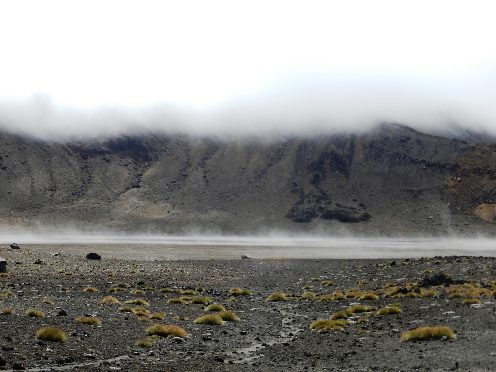
We literally have on every item of hiking gear and clothing we brought.  Loaner gloves allowed Jeff to leave his hand-socks at home. Wind gusts of 35mph cut through our clothes but luckily the sun peered out to warm things up a bit.  With the trail closing, we did an out-and-back hike for 6+ hours instead of the full 8-9 hour adventure. The topography was striking.  Much of it appeared like a rocky Mars- dotted with small drought-tolerant succulents and rocky terrain. Later, streams and lichen made for a more verdant landscape. One crater area was covered with rolling clouds at our feet as we walked across the flatlands.
Probably one of the best views was actually from the huge windows at the Schnapps Bar at the foot of the mountain. Well, at least it was warmer! And they had Jagermeister… just in case!

Kia Ora, My Little Kiwi!

Kia ora, Welcome to New Zealand. After a long journey we are safe and sound in middle earth as Hobbit aficionados know New Zealand. The country is full of national parks, volcanos, wineries and sheep (due to sheep “emissions” the country can’t meet its limits of the Kyoto Accord). One thing it’s not full of is people.  Only 4.2 million live in the entire country- three quarters live in the North Island. OF these, I believe two thirds are cute guys with even cuter accents!


About 12 percent of the population is Maori, the local indigenous people. According to Maori legend, the demigod Maui sailed from Hawaii in his canoe and caught a huge fish. The fish is supposedly the north island while his canoe is the south island. This week the country celebrated Waitangi Day, marking the date in 1840 when the treaty was signed between the British and the Maori. I must admit I’m having trouble with the Maori words- particularly the names of small towns. Most start with “W” or “T” and are tongue-twisters like Whakatane, Waitara and Waipukurau. To further complicate things, the “wh” is pronounced like “f”, “r’s” are rolled like “d’s” and “a’s” are like “ah.” You should hear me calling out directions from the map.

We settled in quickly into Auckland, the nation’s largest city. The “City of Sails” wraps nicely along the water and boasts of 70,000 boats in its harbor. The quay is dotted with trendy bars and outdoor cafes. Auckland is a livable city with their own version of Central Park (the Domain) and Ponsonby, a leafy neighborhood of wooden Victorian homes and cafes. Jeff was elated to find the Superbowl available at a nearby 115 year-old tavern. I guess Beyonce goes beyond all borders.

We’ve become addicted to flat whites- the ubiquitous creamy latte-like coffees offered in every cafĂ©. I do love my froth but these are beyond description. I’m also feeding my sweet tooth with hokey-pokey, a yummy butter brittle ice cream, and pavlova, the feather-light national dessert much like a gooey merengue. Thankfully, our itinerary is jam packed with activities to work off these treats.

After Auckland we ventured to Waitomo for blackwater rafting in the area’s famous glow worm caves.  This is one of those activities that you can do in other countries but would never be allowed in the litigious US. After suiting up in heavy wet suits and selecting a size-appropriate inner tube (if you sit in it and it sticks to your bum, that’s the one!) we hiked down to Ruakuri Cave. After slithering under low hanging stalactites (remember, stalagmites have a “g” and come from the ground while stalactites have a “c” like ceiling!) we cascaded down freezing underwater waterfalls. Once we dimmed our headlights, we were amazed by the light show of millions of glow worms dotting the ceiling. What a sight! Unfortunately they don’t allow cameras as they want you focused on not drowning or causing bodily injury, so I’ve had to attach a photo from the tour company. 

Next up… hiking the Tongariro Crossing, supposedly one of the finest one-day hikes in the world!  I had better juice up on flat whites!

Sunday, September 4, 2011

Au Revoir, Mont Blanc

After six tough days of hiking, I’ve folded up my hiking poles, packed away a pile of stinking Under Armour clothing and headed to Geneva to celebrate the completion of our Mont Blanc adventure.

Hiking here in Europe was an entirely different experience than hiking to Machu Picchu in Peru.  There, we worried with high altitude and drinking the water but were rewarded with a lost Incan city. Here, we encountered lots of daily mileage and rocky terrain but were rewarded with alpine villages and fine wine as we winded up each day.

The Europeans have an interesting take on hiking. They think nothing of cranking out a dozen miles on the trails on a random sunny Saturday. They will stay in spartan accommodations with shared bathrooms and lumpy mattresses but insist on chocolate croissants and cappuccino at the trailside refuges encountered high on hiking trails. 

During our adventure, we traveled counter-clockwise around majestic Mont Blanc, beginning and ending the journey is picturesque Chamonix, France. Each day was packed with miles of rocky terrain and challenging inclines and descents, but we were greeted to spectacular vistas laden with glaciers, alpine lakes and grassy knolls for mid-day picnics. We visited tiny hamlets bursting with flower boxes and alpine inns. We traveled through France, into the Italian countryside and through Switzerland.  We visited local cheese makers and enjoyed their wares for lunch each day.  We learned of local history, celebrations and customs from our knowledgeable guides.  Local cuisines and wines surely packed on a few kilos. It was challenging each day, but we were more than rewarded for our efforts.  Au revoir, Mont Blanc!

Queen of Queens: Mad Cow at its Best!

I wouldn’t have believed it without a Google search, but welcome to the land of Swiss Fighting Cows!

As we trek across the European countryside, we’ve encountered all shapes and sizes of goats, sheep, marmot (I thought it was just a clothing company!) and cow.  Friends had prepared me for the enchanting symphony of cowbells I’d encounter on our trip.  Imagine hearing a cacophony of ringing bells lilting across the countryside as we go about our journey.

For generations, farmers have placed large (and often heavy and ornate) cowbells around the neck of their milk cows to allow them to quickly find their grazing livestock and bring them in for twice-a-day milking.  The bells sound loudly across the countryside for miles as the animals enjoy grazing in the hilltops.  All that’s missing is Julie Andrews singing “The Hills Are Alive…”

Apparently, the cows like getting milked and line up quickly at the portable milking station and storage tank taken out to the grazing area for the daily ministrations. The cows enjoy the tasty grass until winter approaches and the annual parades and ceremonies are held to welcome them home to lower climes and hay for the winter. I guess this is where the saying about the cows coming home started.

Our guide alerted us that we may see some of the famous Swiss Fighting Cows.  Our group of skeptical and jaded Americans accused her of trying to pull one over on the gullible tourists so we shared our own tales of cow tipping and snipe hunting.  That was, until we got back to civilization and the internet to confirm this exciting competion!

Cow fighting is a traditional Swiss event drawing up to 50,000 spectators a year.  Each year, the canton of Valais and the town of Marigny host a series of cow fights known as combats de reines (“queen fights”). Local district winners vie for the coveted title of La Reine des Reines (“the queen of queens”)  There is no swimsuit competition or scholarship awarded but the value of the winners greatly increases.

These female Herens breed of cows typically get into scuffles in the fields as they assert their dominance of the herd.  Each of these head-to-head butting clashes can go on as long as 40 minutes and end when one contestant either refuses to engage or is pushed from the ring. No worries- horns are buffed down to minimize possible bovine injury.

Spaniards, keep your bullfighting.  Bring on the Swiss fighting cows!

Hard Core vs. Soft Core

I’ve always thought the most difficult people were those who think they are low maintenance but are really high maintenance (of course, I consider myself low maintenance so who am I to judge?) Similarly, as I begin my Mont Blanc hiking excursion, I’m feeling like a bit of a hard core adventurer as I start this 60+ mile trek across the French, Italian and Swiss Alps, rounding Europe’s most famous and celebrated peak. That was, until I reached Chamonix, the quaint French mountain village hosting the Ultra-Train de Mont Blanc.

Frankly, I’d never heard of the UTMB.  These men and women are nuts and are definitely hard core! This annual mountain ultramarathon covering approximately 166km of wicked mountain terrainand elevation gain, takes place annually, beginning and ending in Chamonix.  Some believe it is the most difficult footrace in Europe. These 5000+ athletes don’t have a guide, a bed or a support driver. They run armed with hiking poles, compression socks and headlamps to assist as they trek throughout the night.  Rain, cold and rugged terrain are to be expected.  While the speediest will cross the finish line in slightly more than 20 hours, most take up to 45 hours to complete the course and this year 1100 were forced to drop out along the way.  My most memorable moment was watching four runners hoisting a makeshift sled carrying a disabled little red-headed girl over the finish line.  While no prize money is awarded to the winners, this team and their accomplishment was priceless.

Our group of six took the decidedly more soft core approach.  We head out on Monday with our lead guide, Flo, a 40-something lithe bundle of muscle, and our driver/ assistant guide, Laurent, a lean Frenchman with unbridled energy and enthusiasm.  Our group, all experienced hikers, are ready with our Camelback bladders in backpacks, rain gear on ready alert, Voltaren on our achy knees and stories to keep each other entertained as we conquer the trails of Mont Blanc.

Wish us soft core luck!

Tuesday, July 26, 2011

Hail? REALLY?

We packed up early for our adventure to Lake Hope.  Two-way radios- check. High energy snack foods- check.  Rain gear and hiking poles- check.  Now, if we could just find Lake Hope.  Armed with three (yes, three) hiking trail references, we went off in search of what was billed as a hike to lovely Lake Hope, a high-altitude alpine lake nestled in the mountains south of Telluride.  Unfortunately, every guide provided different directions to finding the elusive trailhead.  We circled lakes, ended at posted “Private Property” signs, and finally mounted a drive up a rocky dirt trail up a mountainside (reminiscent of Costa Rica) to start our hike.  Surely, we’d need all our gear as we’d never encounter homo sapiens during the day- only wildlife and wildflowers were on our agenda.

 
After miles up the trail- Eureka- we arrived, only to find a dozen other cars already parked- their drivers already enjoying our private hike. We’ve determined Telluride is not the place to attempt an illicit affair. We keep running into the same local hikers (and their big dogs, of course!) on different trails each day. So much for quiet moments!
 
But the trip was well worth it.  Long stretches of switchbacks through the forest trail dotted with magenta and yellow wildflowers helped ease the pain of the 2000 foot ascent.  When we finally arrived at the lake, it was well worth the effort.  At close to 12,000 feet, ice flows still floated on the lake surface and snow crept across the mountainsides ringing the lake.  We began to enjoy our snacks when a hailstorm began.  Actually, hail is better than rain since it quickly bounces off your head!  Unfortunately, hail brought its cousins thunder and rain to the party so we hurried down- drenched but happy from the adventure.  Why is the drive down the mountain always so much easier? 

But It's a Dry Heat!

Who decides to leave a 72 degree mountain retreat and head off to hike in the Moab desert in 100 plus degree temperatures?  Apparently, we do! When we found out that the famous Arches and Canyonlands National Parks were only two hours away (western geography was never a strength of mine!) we figured we had best go visit- we may never pass this way again.


After a two hour journey across breathtaking mountain ranges on winding switchback roads, we arrived in Moab, a small Utah town nestled smack-dab in the middle of a handful of national and state parks.

We were not fully prepared for the beauty of the landscape in the area.  Within a few miles of each other, Arches and Canyonlands Parks offer visitors quite different topography.  Arches NP, attracts over a million visitors each year- all eager to view its iconic images like Balanced Rock or Delicate Arch.  Rangers constantly warn visitors to avoid hiking during the hot part of the day and drink copious amounts of water.  On the day we toured, the car touted a temperature of 122 when we returned from our hike.  After running the AC, it quickly dropped down to a balmy 99!


Just down the road at Canyonlands NP, we attended a ranger talk on the geology of the park (fascinating!)  It makes you realize we are miniscule in the scheme of things when you see what thousands of years of wind, rain & gravity can do to form these stunning canyons, waterways and rock formations.

My big question is, if aptly-named Arches NP has amazing arches & rock formations, and Canyonlands NP has canyons deeply cut by the Colorado River, what is going on at nearby Dead Horse Trail State Park?   

Wednesday, July 20, 2011

My Million Dollar Telluride Idea

Telluride is a magical place- the kind of place that offers you its beauty and charm both in winter and summer seasons. While we’ve skied here several times, this was our first foray into summer at Telluride and hopefully, won’t be our last.

Because it is a more newly-developed, everything is aesthetically pleasing and well planned.  That’s not to say that the town isn’t rich in history. Snuggled into a box canyon in the San Juan Mountains, Telluride, once known as the City of Gold, is now a National historic District.  Spanish explorers came in the late 1700s, followed by fur traders and the Ute Indians, and later persevering miners in search of riches. 

Today the town is still sprinkled with historic buildings and charming renovated miner homes. Nestled alongside these quaint structures and dotting the hillside are opulent stone and wood homes for the town’s wealthy residents (Tom Cruise lives in our “hood”.  No Suri sightings yet!)  Top-notch hiking trails and bike paths snake along the downtown creek and up the side of adjacent Bear Creek Mountain.  The hot yoga studio doesn’t publish fees, but asks you to pay what you can (although they suggest you “can” afford to pay between $12 and $20 a session) and the local medical marijuana stores appear to be doing a healthy business. Somehow, it all just “works” to make Telluride a highly “livable” location with a young, laid-back, healthy vibe.

But who rules this quaint town with its main street dotted with flower boxes and local hardware store coexisting side-by-side with  trendy shops and organic restaurants? 
It’s the DOGS! 

I’ve come to realize that there are probably more dogs than humans in this town.  And they appear to be revered by its residents! Telluride would put Paris and New York to shame.  On our first day of hiking, on the trail we noticed that almost everyone we encountered had their dog with them.  Since then, we see them everywhere- on the gondola, reigning over stores, and my favorite, quietly sitting on a bar stool with his human at a trendy mountainside bar last night- watching the sports channel.

Now for my plan- Telluride Rent-a-Dog!  For those visitors or those new-to-the-area who want to immediately fit in and have an instant friend an status symbol (without the worry of crating and airplane travel.)  And these can’t be normal sized dogs.  The bigger, the furrier, the slobberier the better.  Lolling tongues and panting are a plus.  Labs and Goldens will be our specialty . And they will have “immediately friendly” names to match- Rusty, Bo, Buddy, Mac and as a nod to my Southern heritage, Dixie.  These new friends will serve as hiking partners, provide entry into any and all local establishments and be great for picking up members of the opposite sex.  And they will even come with a tennis ball for play! 

Investors, anyone?


Monday, August 30, 2010

What Once Was Lost, Now is Found

Finally, after six drays of trekking, we arrived at Machu Picchu!

Talk about a happy accident. Yale historian Hiram Bingham, the man credited with re-discovering Machu Picchu, the Lost City of the Inca, was actually on the hunt for another city when he happened into this magical site. Bingham and his team of explorers arrived in Cusco in 1911 with hopes of finding Vilcabamba, the LAST city of the Incas. Since the local Quechan language is spoken and not written, little survived from the Incan times to tell of Machu Picchu (meaning Old Mountain in Quechan.) Local maps to Vilcabamba showed another settlement and as Bingham headed off to Vicabamba, he uncovered Machu Picchu which lay directly in its path through the Sacred Valley. Actually, locals continued to farm the flat, sunny terraced areas of the city and the Incan Trail had served as a local supply route since ancient times. The site had gone undiscovered by Spanish conquerers and later explorers due to its heavily overgrown vegetation. Even from nearby Agua Calientes, you can look directly up to the site and not see it. Bingham later returned to the site in 1915 with a band of scientists to uncover remains and begin research.

The real boom to the city came in 2007 when the site was named one of “The Seven Wonders of the World.” This led to efforts by UNESCO and the Peruvian government to carefully restore and preserve the site. Daily crowd limits to both the site and the Inca Trail serve as a means to keep the site intact.

Built in the mid-15th century, Machu Picchu was a sanctuary for Incan royalty. The landscape is stunning with orchids and the massive cliff face of Huayna Picchu towering overhead. The city is divided into three sections- the Sacred District, the Popular District and the District of the Priests and Nobility. The architecture and location indicate the site is a sacred place. Numerous nearby archeological sites such as the one we visited the day before all face Machu Picchu. As with other sacred buildings, the finest craftsmen build the site’s temples using perfectly fitted stones and no mortar. Agricultural and less important structures use rougher stones and mortar. Incan architectural elements such as trapezoid windows, inward slanted walls and terraced planting areas reinforce the stability of Incan building and city planning techniques.

Theories abound as to why the city was abandoned. Some speculate it served as the estate of a local ruler and was deserted upon his death. Others theorize that disease brought by Spanish conquerors ultimately led to the city’s demise.

When he left in 1915, Bingham took 174 boxes of human remains and artifacts to the U.S. for further study. Most reside today in the Peabody Museum in CT and the Peruvian government continues to negotiate the return of these artifacts.

What a fitting end to our journey. After an overnight stay in Cusco, I’m headed off to the Peruvian Amazon.